The latest
Ukraine is using near-real-time commercial satellite imagery to speed up drone strikes on Russian targets, in what the Wall Street Journal described as a first in modern warfare.
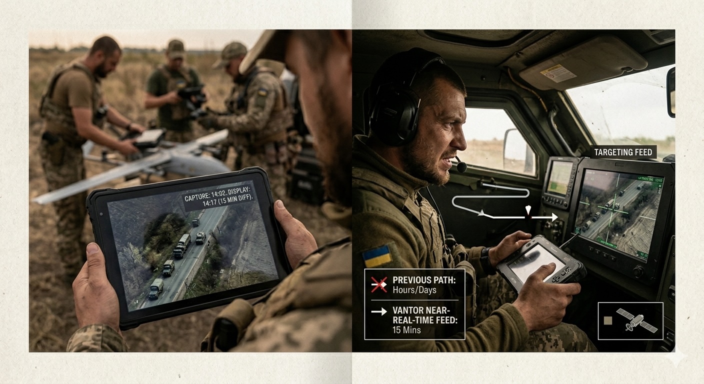
According to the paper, images from satellites operated by Colorado-based Vantor now reach Ukrainian drone operators’ devices roughly 15 minutes after capture. The data previously passed through centralized intelligence review, which could delay delivery for hours or even days.
Details
• The Journal said the system has reduced the time from target detection to strike by as much as 90%.
• The faster feed helps Ukrainian forces locate Russian military assets and hit them before they can relocate.
• The system was built through a partnership involving Vantor, Dutch firm Bravo1Alpha, U.S.-based Persistent Systems and Ukrainian defense company Bureviy.
• Vantor was previously known as Maxar Intelligence and specializes in geospatial intelligence and Earth observation.
• The same satellites are also used for civilian purposes, including monitoring illegal fishing, tracking infrastructure and updating mapping services.
• The development follows a disruption in Ukraine’s access to satellite intelligence. In March 2025, the U.S. government suspended Kyiv’s access to imagery purchased through the Global Enhanced GEOINT Delivery system as part of a broader pause in intelligence sharing.
• Commercial channels for buying satellite imagery remained open, however. The Vantor partnership appears to have given Kyiv an alternative route for battlefield intelligence.
What to watch
The question now is whether this model becomes a routine part of Ukraine’s battlefield operations. If it works at scale, other militaries may move faster to connect commercial satellite imagery directly to frontline units, not just distant intelligence centers.